How Lines on a Map Change the Weight of a Ballot
Ballot Boxes Look the Same, But Constituencies May Not Be; Article 113 and the Thirteenth Schedule Draw Politics on a Map
At the end of the previous chapter, the ballot went into the box.
But before the ballot went into the box, it first had to walk across a map.
There are lines on the map.
The lines look quiet.
No speeches.
No flags.
No candidates shaking hands.
But the moment a line moves, the weight of the ballot may move with it.
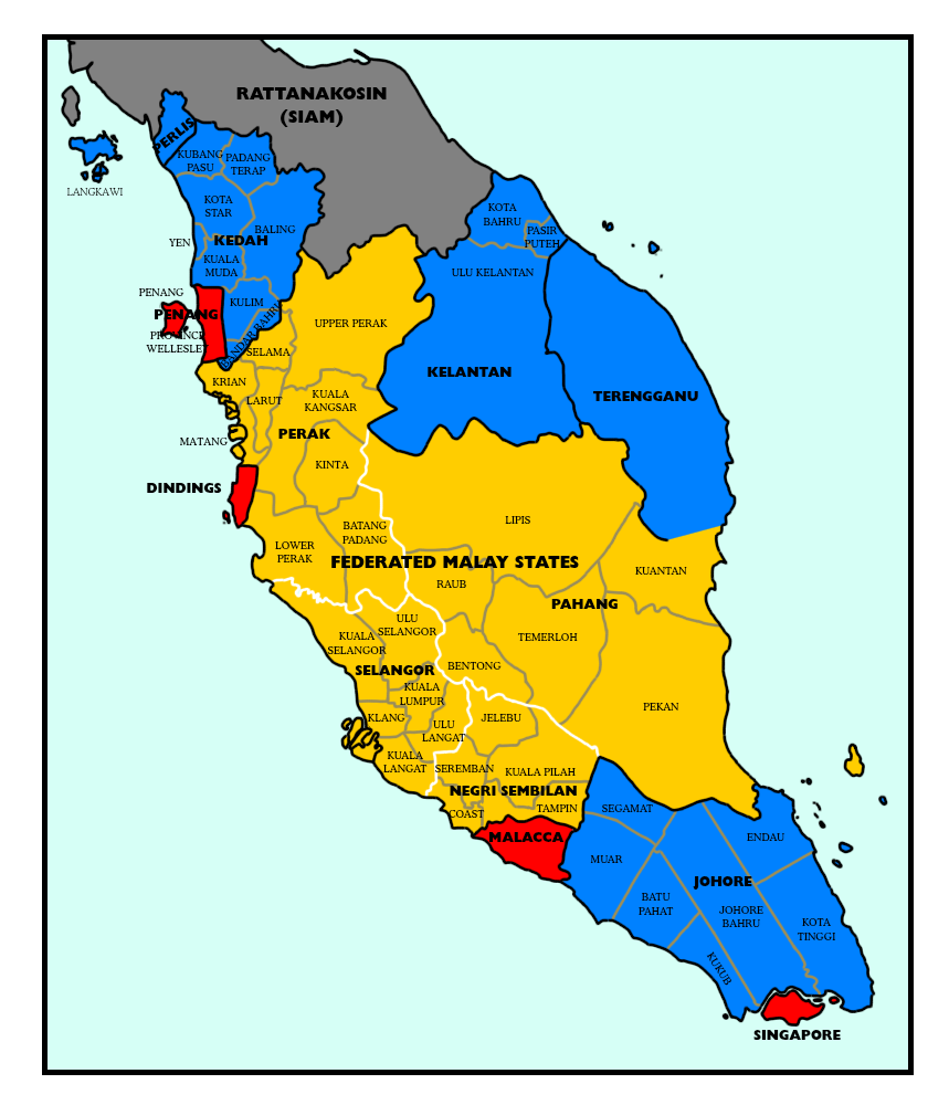
The Same Ballot Does Not Necessarily Yield the Same Distance#
Imagine two constituencies.
One constituency has many people.
The other constituency has few people.
Both only elect one Member of Parliament.
The ballot paper is the same size.
The ballot box is just as transparent.
The counting procedure can be identical.
But here lies the problem:
In the constituency with many people, many votes are exchanged for one seat.
In the constituency with few people, fewer votes are exchanged for one seat.
And so, what is equally called "one vote" no longer carries the exact same weight by the time it reaches the doors of Parliament.
This is why constituency redelineation turns into a political live wire.
Article 113: The Map Must Be Periodically Reviewed#
Article 113 does not only empower the Election Commission to conduct elections and prepare electoral rolls.
It also tasks the Election Commission with reviewing the division of the Federation and the States into constituencies within constitutional limits, and recommending such changes as they may think necessary to comply with the Thirteenth Schedule.1,4
This sounds like the work of a cartography department.
But what it is actually asking is:
After populations have moved, are the old boundaries still fair?
After cities have expanded, are the old seats still enough?
Given that rural areas are vast and transportation is difficult, should there be some different considerations?
Between states, between districts, between villages and towns, how should political communities be carved up?
These are not purely mathematics.
Nor are they purely sentiment.
They are the Constitution placing numbers, geography, and community relations on the same table.
The Thirteenth Schedule: What the Line-Drawers Must Look At#
The Thirteenth Schedule lists the principles for delineating constituencies.
These include administrative facilities available, conveniences of registration and voting, maintenance of local ties, roughly equal numbers of electors across constituencies, and a measure of weightage to be given to rural constituencies facing greater difficulties in reaching electors.1,4
Every word sounds like ordinary language.
But every word can be argued over.
What does "local ties" mean?
Are a new township and an old village the same political community?
Are people on both sides of a major highway the same group of people?
How should rural difficulties be calculated?
Transportation difficulties can justify a constituency being smaller in population.
But how small is still reasonable?
Without clear boundaries, "catering to inconvenience" could be described as "manipulating weightage."
This is the hardest part of the Thirteenth Schedule.
It gives principles.
But principles must land on a map.
And the map will not answer controversies by itself.
Publication, Objection, Enquiry#
Constituency redelineation does not end when the Election Commission finishes drawing behind closed doors.
The procedure in the Thirteenth Schedule requires the proposed recommendations to be published, allowing state governments, local authorities, or a specified number of voters whose names are on the electoral rolls to make representations; under certain conditions, the Election Commission must hold a local enquiry.1,4,2
This part is very important.
Because if the map is only drawn in an office, the people will only discover where they have been placed on election day.
The publication and objection procedures exist so that before the lines become final boundaries, they can be seen, debated, and questioned for justifications.
Of course, the existence of a procedure does not mean controversies disappear.
Some will say the enquiries are too limited.
Some will say ordinary voters cannot read maps.
Some will say objections may not change the outcome.
These criticisms require specific cases to verify.
But at least within the constitutional structure, constituency boundaries are not entirely silent administrative actions.1,2
There are public steps.
And there are cracks for the people to interject.
Only After the Lines Are Drawn Does the Story Truly Begin#
Once the constituencies are set, political parties start recalculating.
Where is safe?
Where is marginal?
Where should heavyweights be deployed?
Where do we just need to hold the base?
Candidates look at the map.
Campaign managers look at the map.
The media looks at the map.
Ordinary voters might not look at the map every day.
But the map looks at them every day.
Because it determines who they are counting votes with.
It determines how many people's votes their own vote is competing against for a single seat.
It determines how a national popular vote will ultimately translate into parliamentary seats.
Why the Controversies Drag On and Deepen#
Constituency redelineation in Malaysia has been debated for a long time; one reason is the ongoing controversy over rural weightage, voter disparities, and the political landscape.
Some secondary analyses point out that later constitutional amendments and redelineation exercises altered early restrictions, making rural weightage and constituency size disparities long-standing political issues.3,1
We must be careful here.
We cannot simply describe every boundary as malicious.
Geography does exist.
Mountain roads, rivers, islands, and rural service distances do make representation more complex than just simple population averages.
But neither can we describe all disparities as geographical necessities.
Because boundaries are drawn by humans.
Things drawn by humans must accept human questioning.
One Line, Two Languages#
Those who draw the lines often use technical language.
Population.
Topography.
Administrative units.
Polling districts.
Local ties.
Those who object often use political language.
Unfair.
Malapportionment.
Biased.
Slicing communities.
Diluting support.
Both languages might make sense.
And both might be abused.
So our reading method is this:
First, read the provisions.
Then, look at the map.
Then, look at the numbers.
Then, look at who benefits and who suffers.
Do not start by calling all lines a conspiracy.
But do not stop suspecting just because it is called a "technical procedure."
Evidence for This Article, Clearly Explained#
The constitutional structure of constituency redelineation is based on the AGC Federal Constitution. Article 113 and the Thirteenth Schedule are the core; the Constitute Project is used solely for secondary compilation cross-referencing.1,4
Public objection and enquiry procedures are cross-referenced with the Malaysian Bar's legal explanations. This article only describes general procedures and does not comment on the legality of any specific redelineation exercise.2,1
Rural weightage and subsequent controversies use New Mandala as a background prompt. If specific redelineations like 1962, 1973, 2018, or separate ones for Sabah and Sarawak are to be written about, separate topics must be opened, supplemented with official reports, parliamentary records, maps, and seat data.3,1
This article is sensitive: true. It touches on constituency delineation, electoral fairness, party competition, and ethnic/urban-rural representation controversies; the original draft was reviewed line by line by Jay before publication.
Next up: The map divides ballots into constituencies, and constituencies send people to Parliament. But there is another problem inside Parliament: when an MP leaves their original party, who does the ballot cast by the voter actually follow?
Sources 4 Every important claim here can be checked. Open it and see.
Do not trust this site. Check it — every source below is clickable.
This site is written with AI assistance. Please check us.
AI can invent citations that look completely convincing — a real author's name, a plausible title, a sensible year, for a work that does not exist. This is not a theoretical risk; it is a known failure mode. That is why every source on this site is clickable. If a reference cannot be found anywhere, it may well not exist — and we want to know.
How to check us →
Reader Comments
Be the first to share your thoughts.