Where Did the Melaka Royal Line Go After 1511?
After the fall of Malacca, the royal lineage was not broken—it retreated south and later branched into two kingdoms
One day in July 1511, a fleet anchored outside the port of Malacca.
At that time, it held everything accumulated over a century: spices, silk, gold dust, the cacophony of no fewer than eighty-four languages, and the order maintained by four Syahbandars managing their respective docks. None of these came by chance.
Then the cannons began to roar.
The Sultan Fled#
After the city was breached, Sultan Mahmud Shah made his exit.1,4
He did not choose to fight to the death. He led his followers eastward, first arriving in Pahang to catch his breath on the east coast, before heading south—crossing the strait to a place called Bintan (Bentan) in the Riau Archipelago.1,4
In Bintan, he managed to secure a foothold for a while. He even fought back—in the late 1510s, he organised attacks on the Portuguese-occupied Malacca, provoking the enemy.1,4
In 1526, the Portuguese forces crossed the sea and attacked.1,4
According to the Wikipedia entry 'Siege of Bintan', the commander of the Portuguese forces besieging Bintan was Dom Pedro Mascarenhas, commanding a force of about six hundred Portuguese soldiers and several hundred Malay auxiliaries. Mahmud Shah escaped into the jungle before the Portuguese arrived and was not captured. (Currently, the only source for the details in this paragraph is the Wikipedia entry, and this site notes it as such.)
He retreated further south, this time into the interior of Sumatra—Kampar.5,4
As for the year of his death there, the sources are inconsistent: some write 1528, others 1529, and another theory suggests 1527. Which one is correct remains inconclusive, and this site will not adjudicate. A ruler who lost his kingdom dies in a foreign land, and even the date of his death cannot be agreed upon—this itself reflects the nature of history in that era.5,4
From setting out from Malacca to closing his eyes in Kampar, he had journeyed for seventeen years.
One Royal Lineage, Two Kingdoms#
He died, but his sons were still around.
Mahmud Shah had several sons. Two of them had already begun to strategise while their father was in exile:
Alauddin Riayat Shah II—the son of Mahmud Shah and Tun Fatimah—established a kingdom in the Johor River basin in the southern Malay Peninsula, marking the beginning of the Johor Sultanate.6,4 Its capital was established in Pekan Tua, a place near present-day Kota Tinggi.6,4
The founding year of the kingdom also sees a one-year discrepancy among sources: some write 1528, and others write 1529. Such variations are common in this history—the "beginning" of a dynasty is never announced on a specific morning; it is a point designated by later generations.
Muzaffar Shah I—the son of Mahmud Shah and the Kelantan princess Putri Onang Kening—also in 1528, headed north and established a kingdom in Perak, becoming the first Sultan of the Perak Sultanate, reigning until 1549.7,3,2
Regarding the birth order of these two men, historical accounts from various periods differ. The Sejarah Raja Perak (History of the Kings of Perak) refers to Muzaffar as the "second son"; the Wikipedia entry for Alauddin also calls him the 'second son'—these titles do not contradict each other since they were born to different wives, meaning the method of calculation naturally differs. The academic authorities Winstedt and Wilkinson, in their 1934 JMBRAS monograph, confirmed the father-son relationship between Muzaffar Shah I and Mahmud Shah but did not draw a conclusion on his sibling order.3,2
This site will not determine their seniority. What matters is the fact: just months after their father died in Sumatra, these two kingdoms were successively established on this side of the strait.
The Kingdom Spanned Both Sides of Today#
We must pause here and look at a map.
The Johor Sultanate continued to expand southward in the ensuing years—the Riau Archipelago, the Lingga Islands, extending all the way to the coastline of what is today called 'Indonesia'.8,4 When this kingdom was established in 1528, nobody imagined that one day there would be a line slicing it in half, causing one half to be called 'Malaysia' and the other 'Indonesia'.
Because that line did not exist then.
Where Did the Other Royal Lineages Come From?#
The narrative of this group of articles now takes shape here.
It wasn't just Mahmud Shah's descendants who retreated from the Sumatran side. For several sultanates on the Peninsula today, their royal lineages also trace back across the strait.
In 1766, a prince named Raja Lumu established the Selangor Sultanate on the west coast of the Peninsula, and was installed as the first Sultan with the title Sultan Salehuddin Shah. He hailed from the Bugis nobility of Sulawesi.9,10 The Sultan of Selangor reigns to this day, and the royal lineage traces back to the Bugis of Sulawesi.
In 1773, Raja Melewar became the first Yang di-Pertuan Besar (Yamtuan Besar) of Negeri Sembilan. He came from the Minangkabau palace of Pagaruyung in Sumatra, invited across the sea to rule this land.11,12
These are not secrets, nor are they arguments to attack anyone—this is the actual reality of how royal lineages have been inherited on this land. The founders of several kingdoms came from the land known today as 'Indonesia', crossed the sea, took root here, and grew their respective histories.
The City Fell, But the People Remained#
The city of Malacca changed its face in 1511, but it did not disappear.
The Portuguese occupied the city, came to collect taxes, and built a fortress, but they did not expel everyone. The port remained open, and merchants continued to arrive.
During the Dutch period (after the Portuguese were ousted by the Dutch VOC in 1641), there was a recorded census of the population in Malacca. According to Governor Balthasar Bort's 1678 Report (translated by M.J. Bremmer, edited and annotated by C.O. Blagden, included in JMBRAS, Vol. 5, Part 1, 1927), the estimated population of the entire city was as follows: about 716 Chinese, 761 Moors (Muslim merchants) and Gentoos (Hindu South Indians) combined, 768 Malays, and about 2,000 Portuguese Eurasians and Blacks, totaling roughly 5,400 people. This report is one of the more systematic records surviving from this period, and all numbers cited by this site are drawn from this single source.
There is also an earlier census of the urban area from 1675, also found in the materials attached to the aforementioned Bort Report, which shows 106 Chinese in the urban area, with a total of over 5,300 people—but the parameters for these two sets of numbers are different; the former is a city-wide statistic, while the latter counts only the urban area, so they cannot be directly compared. This site lists the two sets of numbers separately for the reader's own judgement.
The city fell, but the commercial society did not dissolve. The Chinese were there, the Indians were there, the mixed descendants were there, and their respective communities continued to operate.
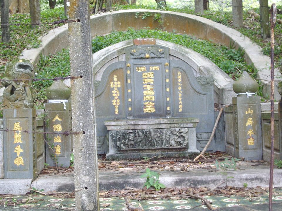
The Kapitan Cina (Captains of the Chinese) who have written records during the Dutch era, according to the Wikipedia entry 'Cheng Hoon Teng', include Li Wei King, who greatly expanded the Cheng Hoon Teng Temple in 1673—he donated the hill at Bukit China as a Chinese cemetery and brought building materials from China to reconstruct the temple. (Currently, the only source for the details in this paragraph is the Wikipedia entry, and this site notes it as such.)
The founding year of the Cheng Hoon Teng Temple is 1645 (during the Dutch era). There is a stele inside the temple inscribed with the Wanli era name, and the 28th year of Wanli is around 1600—which implies the temple site might have existed even earlier. The year 1600 falls in the late Portuguese era. But "might have existed earlier" is an inference, not a definitive conclusion. This site writes it as it is: its founding year is debated, and the current main structure originates from the Dutch era. (Same as above, a single source is noted.)
Also surviving under Portuguese and Dutch rule was a group of people known as the Chitty Melaka—according to records from the National Heritage Board of Singapore, Roots.sg, their ancestors were merchants from Tamil Nadu during the Malacca Sultanate era in the 15th century who married local women, started families, and took root. When the Portuguese came, they were still here. When the Dutch came, they were still here. They maintained their Hindu faith and were not forcibly converted. (The source for this paragraph is a single institutional record from Roots.sg, and this site notes it as such. The original draft also included details about a settlement relocation in 1641, but upon review, it was not found in the source, so it has been removed.)
17 March 1824#
The splitting and merging of royal lineages, the coming and going of merchants, the changing hands of the city—these were experienced by 17th-century Malaccans from within, and they did not need a name to define which side they stood on.
The need to use a name to define it was something that came later.
On 17 March 1824, the British and the Dutch sat down in London and signed a treaty. Article IX of the treaty stated:
"The factory of Fort Marlborough, and all the English possessions on the Island of Sumatra, are hereby ceded to His Netherland Majesty; and His Britannic Majesty further engages that no British settlement shall be formed on that island, nor any Treaty concluded by British authority, with any native Prince, Chief, or State therein."
Article X stated:
"The town and fort of Malacca, and its dependencies, are hereby ceded to His Britannic Majesty; and His Netherland Majesty engages for himself and his subjects, never to form any establishment on any part of the Peninsula of Malacca, or to conclude any Treaty with any native Prince, Chief, or State therein."
When reading these two articles, notice what they do not say. They did not divide any Malay polity, did not mention the name of any Sultan, and did not draw any line. What they say are two very narrow things: certain assets changed hands; and henceforth, neither would establish settlements on the other's side, nor sign treaties on the other's side.
In the text of the treaty, the word "Riau" does not appear. But the consequence was clear: the Peninsula north of the Malacca Strait fell under the British sphere of influence, while Sumatra and the archipelagos south of the strait fell under the Dutch sphere of influence.8,13 The implicit result of this division was the splitting of the Johor-Riau political entity that had originally extended across both sides.
The academic consensus is: it was this line that separated "this side" and "that side"—and not the other way around.8,4
Think about it: before the British and the Dutch sat down, the terms "Malaysia" and "Indonesia" did not exist here, and neither did these two countries. Royal lineages retreated and advanced among the islands; merchants came from Sulawesi, from Sumatra, heading north to the Peninsula and then south—they never had a line that divided them into "people of this country" and "people of that country".
That line was drawn in 1824.
The two people who drew the line, one represented Britain, and the other represented the Netherlands.
This is a conclusion that readers can reach on their own, and this site will not spell it all out for you. Historical materials only state one thing: the line came later; before that, this was a sea.
But the story did not end with the appearance of this line.
After this line was drawn, the British began wanting to seriously manage "this side". They wanted to conduct population censuses, categorise people, and put everyone into manageable boxes.
That system of dividing people into "three major races"—who taught it, where did it come from, was it really a continuation from ancient times, or did someone sit down one day and write it on paper?
Sources 13 Every important claim here can be checked. Open it and see.
Do not trust this site. Check it — every source below is clickable.
-
Search for this source ⌕ no direct link — this button searches for the work 2026-07-30 Report this source
-
Search for this source ⌕ no direct link — this button searches for the work 2026-07-30 Report this source
-
Search for this source ⌕ no direct link — this button searches for the work 2026-07-30 Report this source
-
Search for this source ⌕ no direct link — this button searches for the work 2026-07-30 Report this source
-
Search for this source ⌕ no direct link — this button searches for the work 2026-07-30 Report this source
This site is written with AI assistance. Please check us.
AI can invent citations that look completely convincing — a real author's name, a plausible title, a sensible year, for a work that does not exist. This is not a theoretical risk; it is a known failure mode. That is why every source on this site is clickable. If a reference cannot be found anywhere, it may well not exist — and we want to know.
How to check us →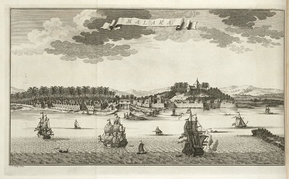
Reader Comments
Be the first to share your thoughts.